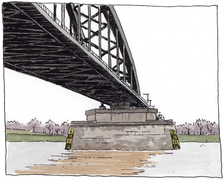
Due to heavy rainfall and melting snow, the water level in the Dutch rivers are very high. I went to check the water level in the River Lek (a branch of the Rhine) in my hometown Culemborg yesterday. In my drawing, you won’t see anything special, but in summer you can walk up to this pilar of the railway bridge (from the opposite river bank of course). If you are wondering why the numbers on the scale on the pilar are lower at the top: the numbers indicate the clearance between the water surface and the underside of the bridge, so shippers know if they can pass. On Wikipedia I found that the ‘normal’ clearance is 16.2 meters.
Vanwege zware regenval en smeltende sneeuw is het waterpeil in de rivieren heel hoog. Ik ging gisteren even kijken bij de Lek in mijn woonplaats Culemborg. Op de tekening is niet veel van het hoge water te zien, maar in de zomer kun je naar deze pijler onder de spoorbrug toe lopen (vanaf de overkant, natuurlijk). Wie zich afvraagt waarom de cijfers op de schaal op de pijler naar boven toe lager worden: de cijfers geven de doorvaarthoogte aan tussen water en onderkant van de brug. Op Wikipedia vond ik dat de ‘normale’ doorvaarthoogte 16,2 meter is.